
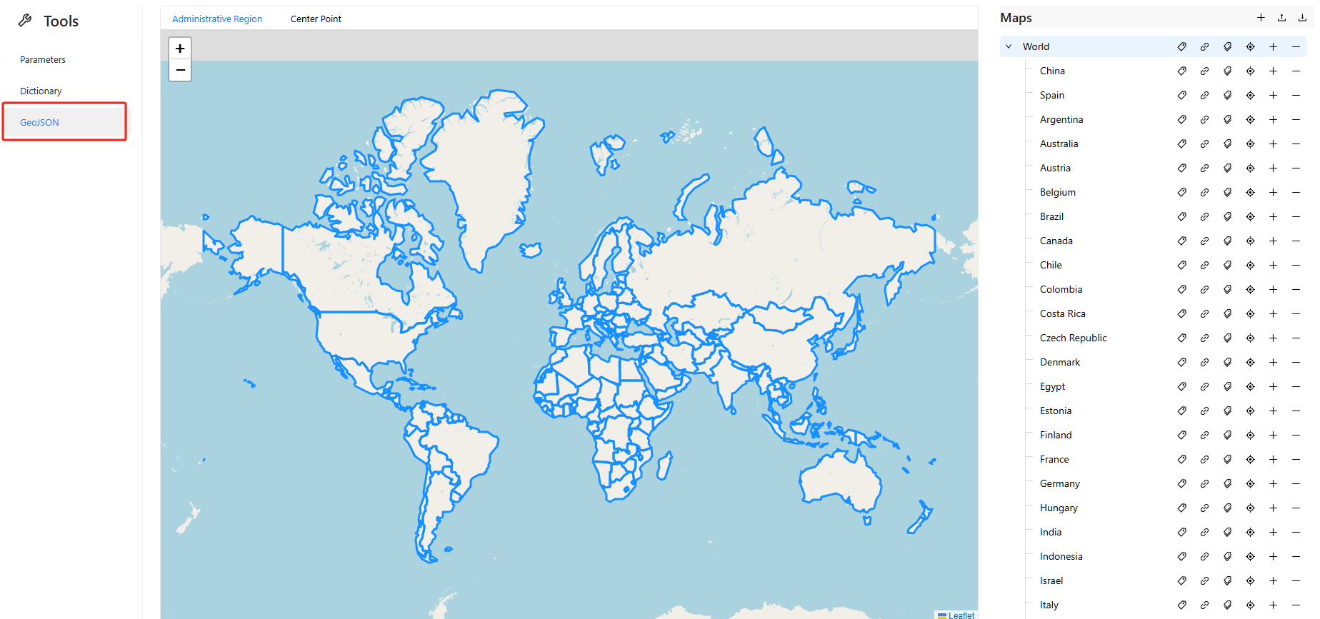
Appearance
GeoJSON Map
Feature Overview
Datafor provides a visual tool for managing and maintaining GeoJSON map data. Through this interface, you can:
- Add world or country/region administrative maps
- Bind GeoJSON map data files
- Set map and region aliases to match your data fields
- Define the central coordinates (latitude and longitude) of each administrative area for GeoJSON map markers
- Add sub-regions to maps (Datafor's GeoJSON map component supports drill-down)
Common Operations Guide
1️⃣ Add a Country Map
- Click the
➕icon in the top-right corner of the “Maps” panel to add a country or region map.
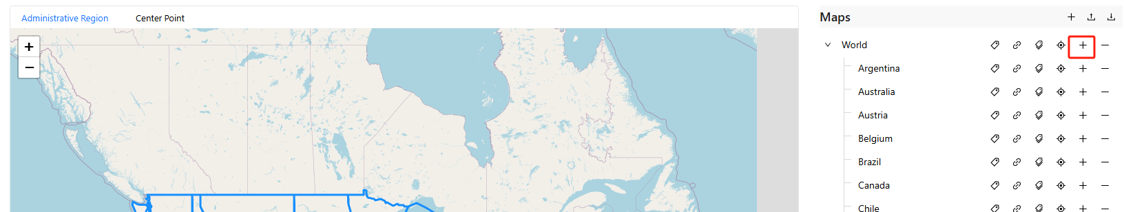
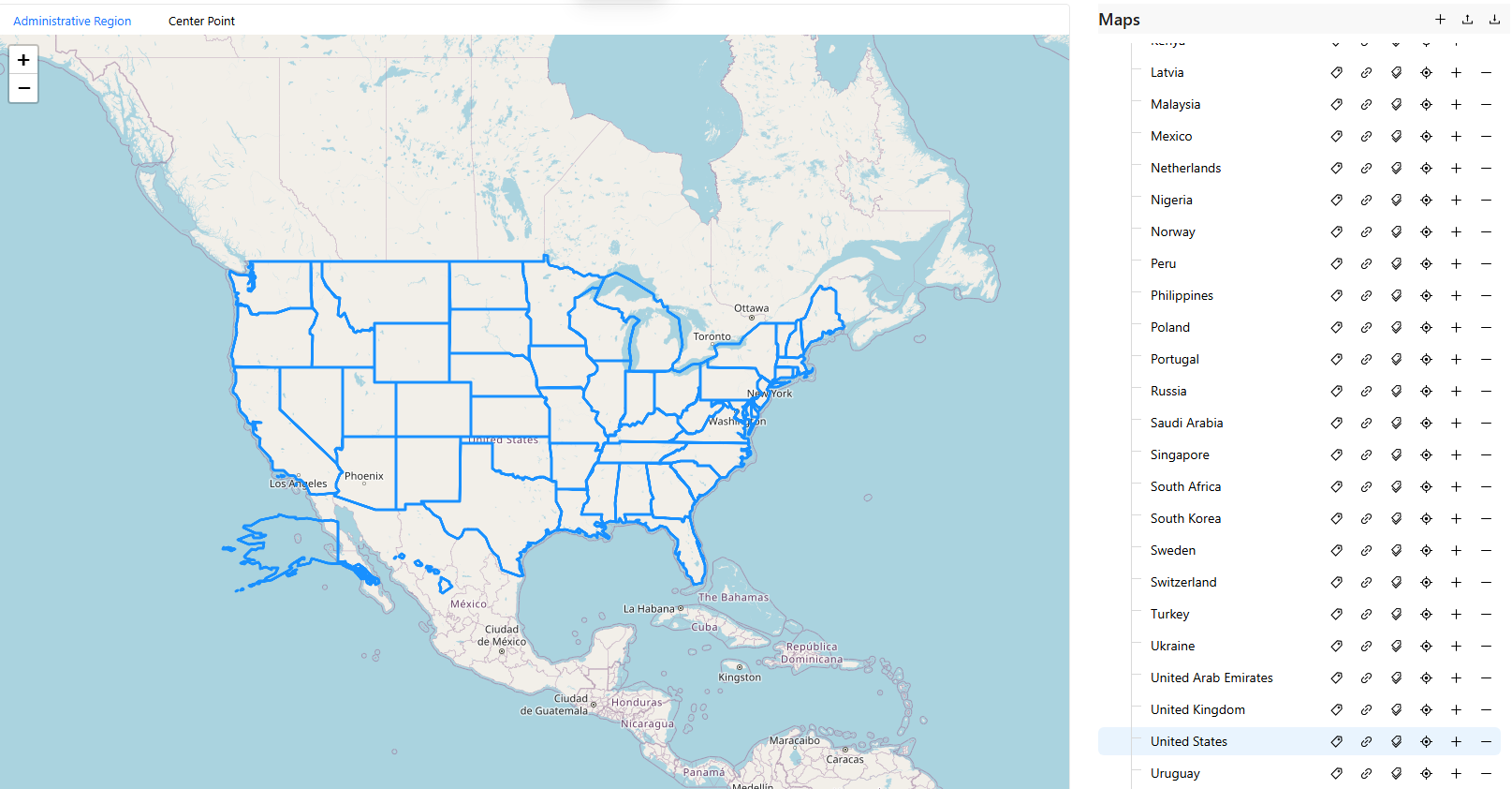
- The list shows countries or regions included in the “World” map.
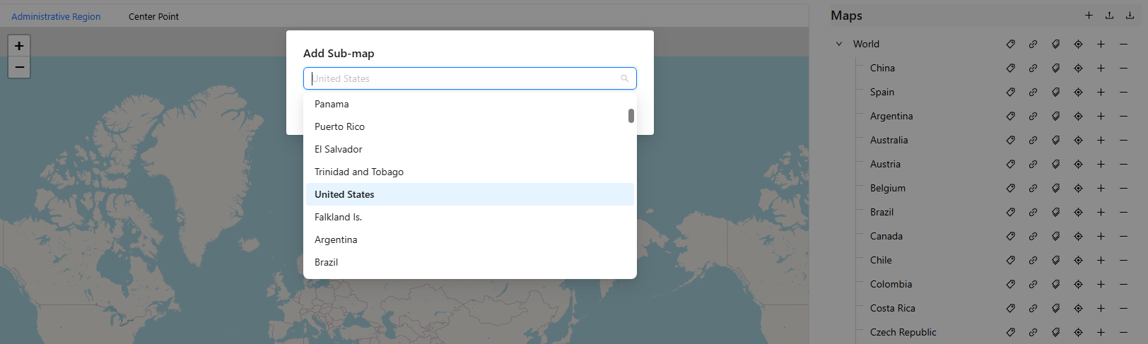
- For example, select “United States”.
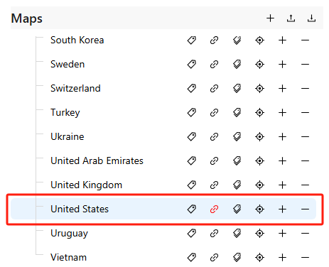
2️⃣ Bind GeoJSON Map Data File
Locate the target map entry (e.g., United States) and click the 📎 icon to bind a data file.

In the upload window, select your GeoJSON file (must be under 1MB).
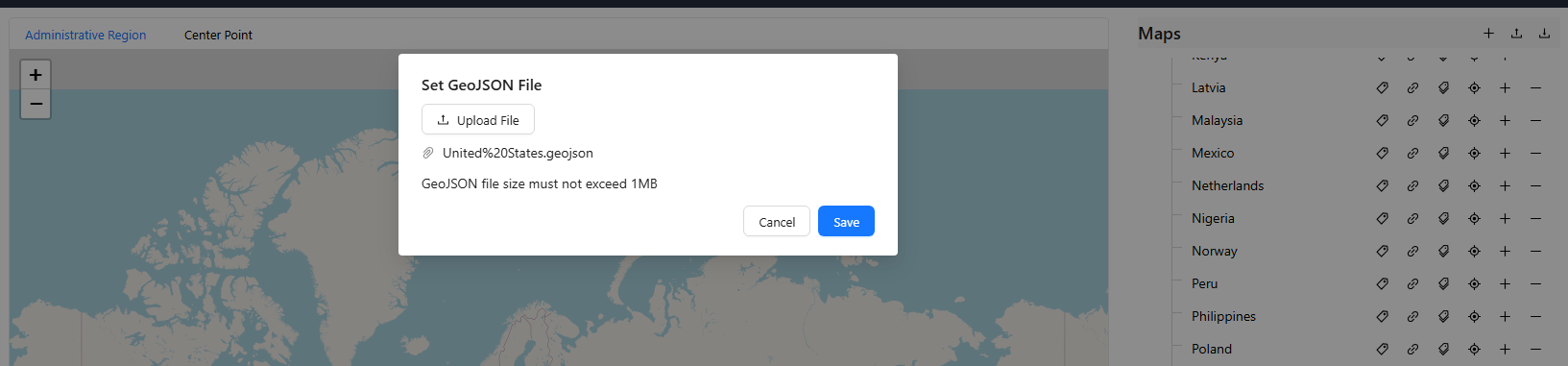
Click Save to complete the binding.
3️⃣ Set Map Alias
To ensure consistency with your data fields, you can configure a map alias:
Click the ✏️ icon next to the target map.

Enter aliases such as
USA/United States/Americain the pop-up input box.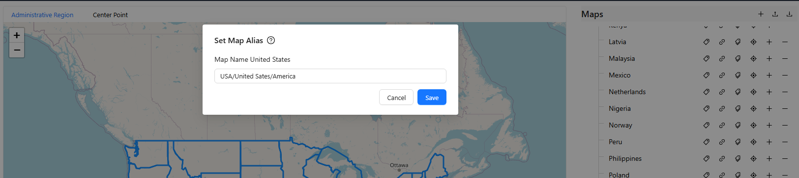
Click Save to apply changes.
4️⃣ Set Region Aliases
If your map includes sub-regions (e.g., states or provinces), you can assign aliases for each:
Click the second ✏️ icon next to the target map.

In the pop-up window, enter aliases for each sub-region (batch import supported).
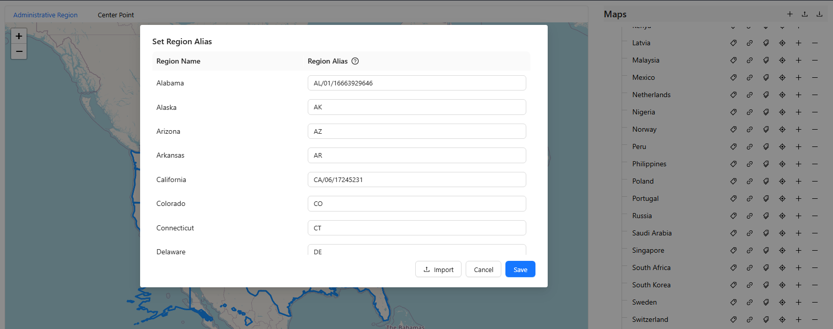
Click Save to confirm.
5️⃣ Add Sub-region Maps (Drill-down Support)
You can use the GeoJSON map component to add drill-down sub-region maps (e.g., US states):
Click the ➕ icon next to the parent map.

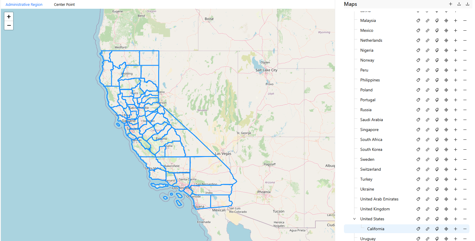
In the “Add Sub-map” dropdown, search and select a sub-region (e.g., California).
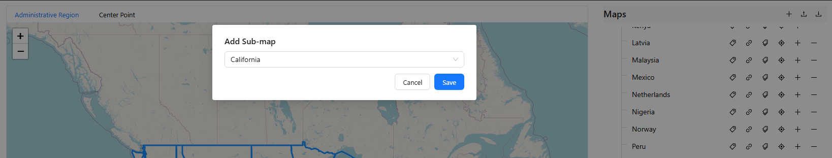
The added sub-map will appear under the parent map.
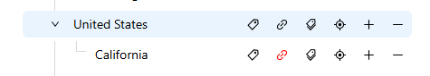
You’ll also need to bind GeoJSON data for sub-regions using the same method.
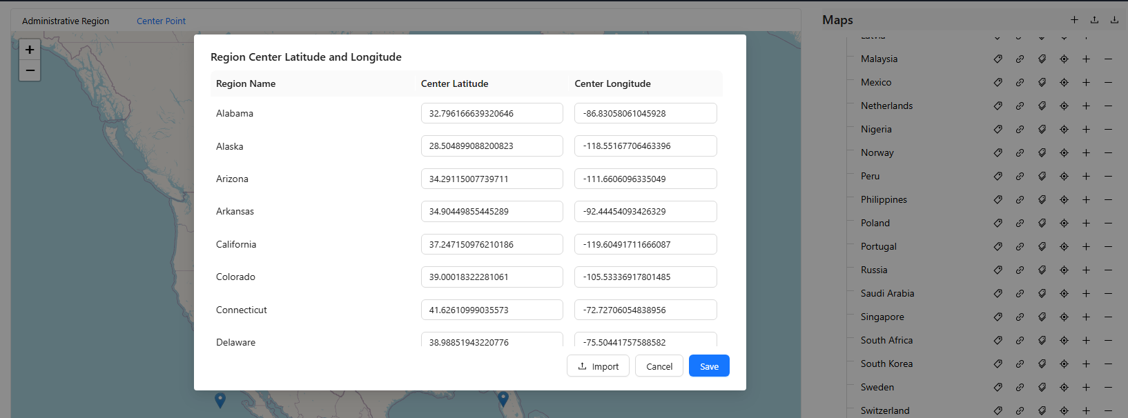
6️⃣ Set Region Center Coordinates
Switch to the Center Point tab at the top of the map to define region center points:
All regions will be displayed as point markers on the map.
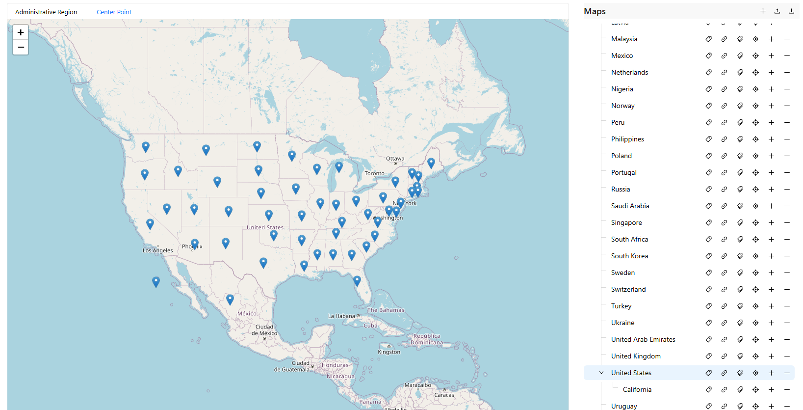
Click the 📍 icon on the right to open the coordinate input window.

You can manually enter latitude and longitude or use batch import.
GeoJSON File Format Requirements
Uploaded map data must comply with standard GeoJSON structure as shown below:
{
  "type": "FeatureCollection",
  "features": [
    {
      "type": "Feature",
      "properties": {
        "name": "California",
        "aliases": ["CA", "California"],
        "center": [-119.4179, 36.7783]
      },
      "geometry": {
        "type": "Polygon",
        "coordinates": [...]
      }
    }
  ]
}
Field Descriptions:
| Field | Description | | ---- | | | name | Region name (system identifier) | | aliases | Region aliases for matching business data | | center | Center coordinates of the region [longitude, latitude] | | geometry | Region boundary; supports Polygon / MultiPolygon |
Recommendations
- Setting correct map and region aliases is crucial for accurate chart display.